|
|
Maps of the North Fork of the Flathead River |
|
|
Maps of the North Fork of the Flathead River |
|
Home
Cline Mine Maps Meeting Agenda February 2007 Legislative appropriation request |
|
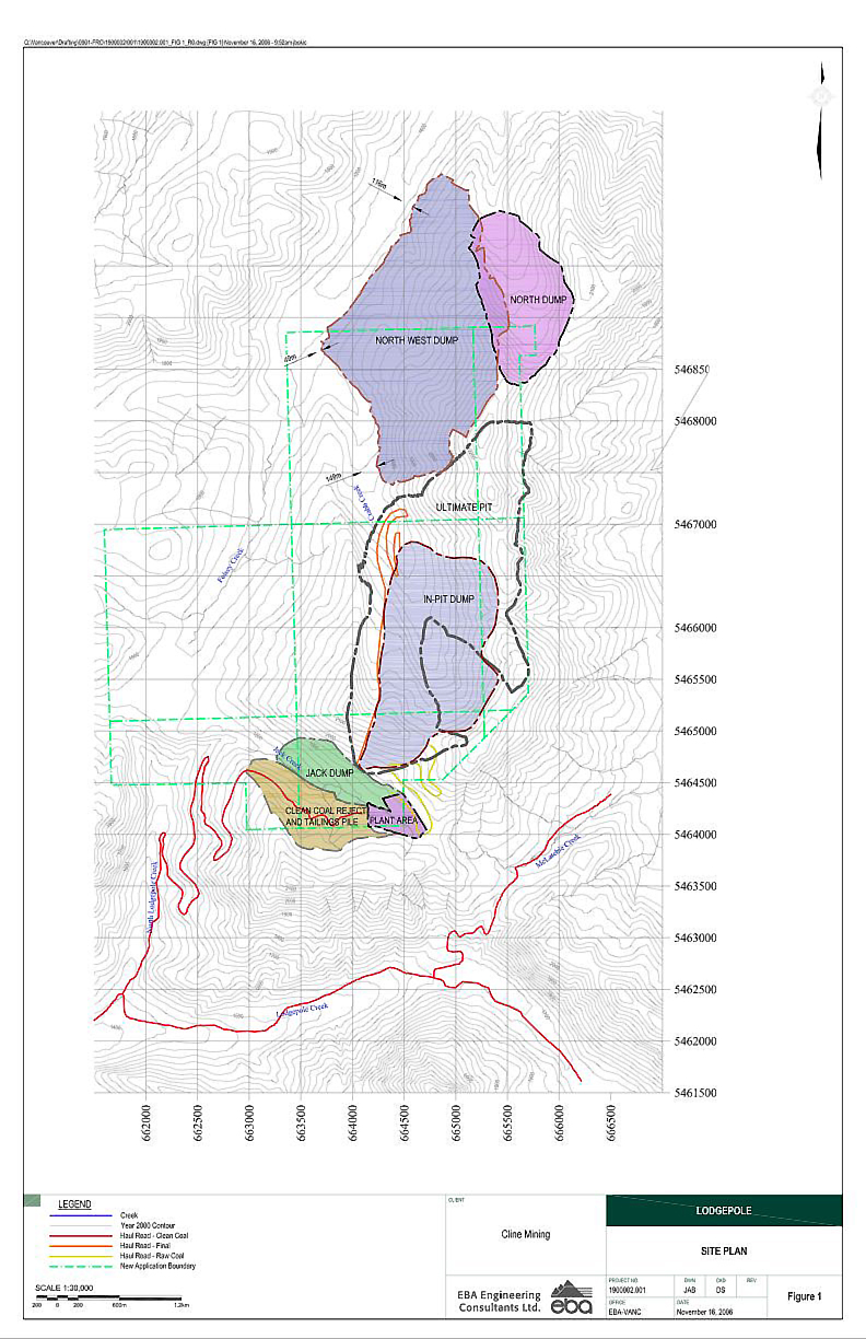
Cline Mine proposed Site Plan with the mine pit and waste dumps in Foisey Creek, headwaters tributary of the Flathead River (Credit: EBA Engineering Consultants) File size 548 kb |
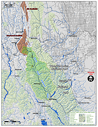
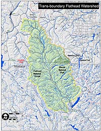
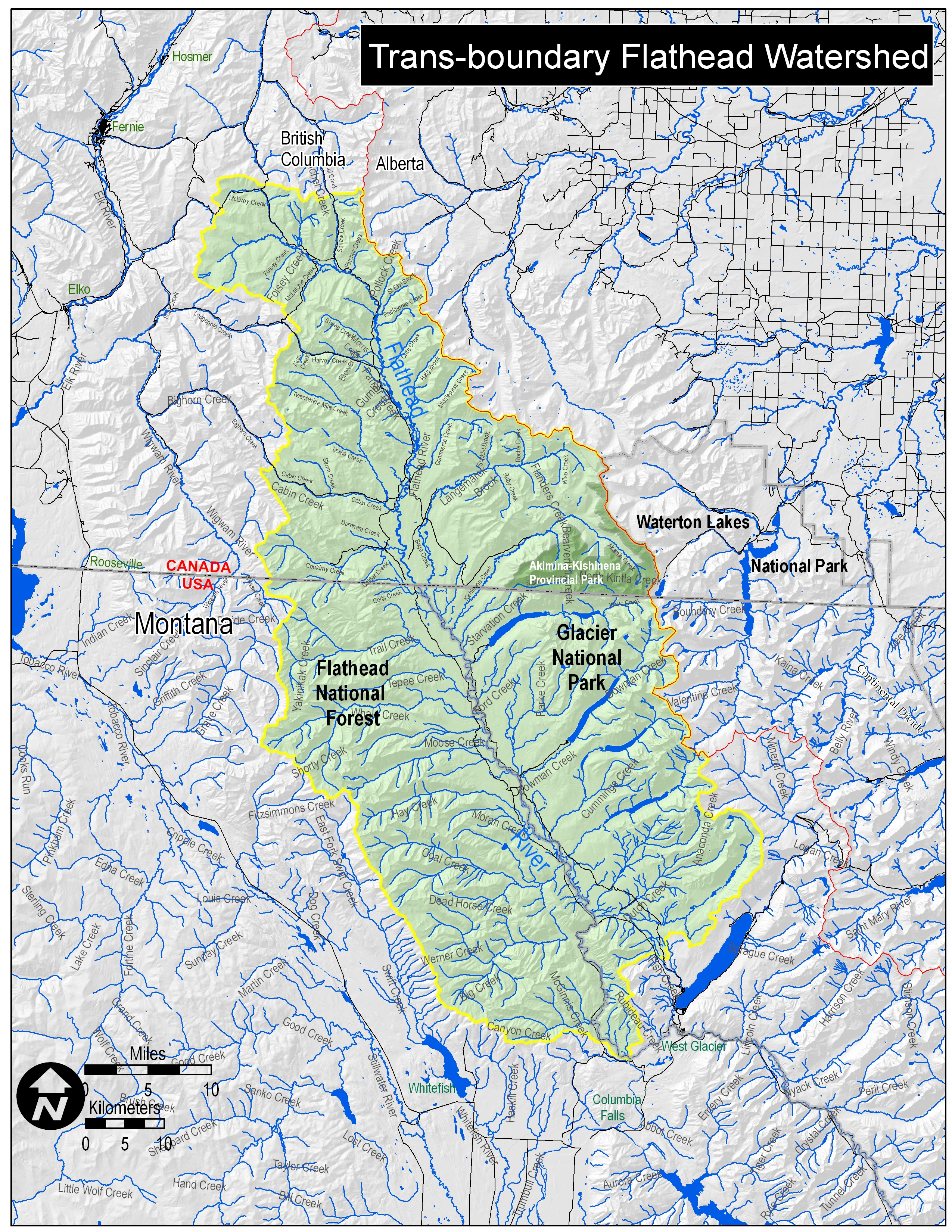
Transboundary (North Fork) Flathead River with Coalfields. Map courtesy of Glacier National Park File size 900 KB File size 7.7 MB PDF File |
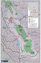
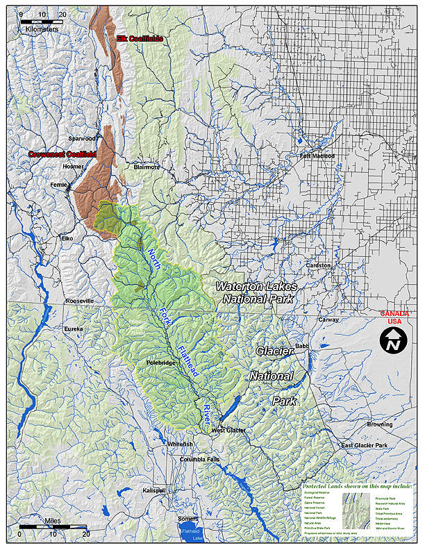
Crown of the Continent Ecosystem with Transboundary Flathead and Coalfields. Map courtesy of the Miistakis Institute File size 276 KB File size 964 kb |

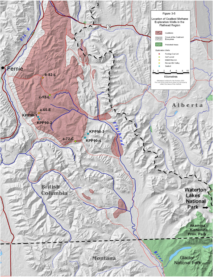
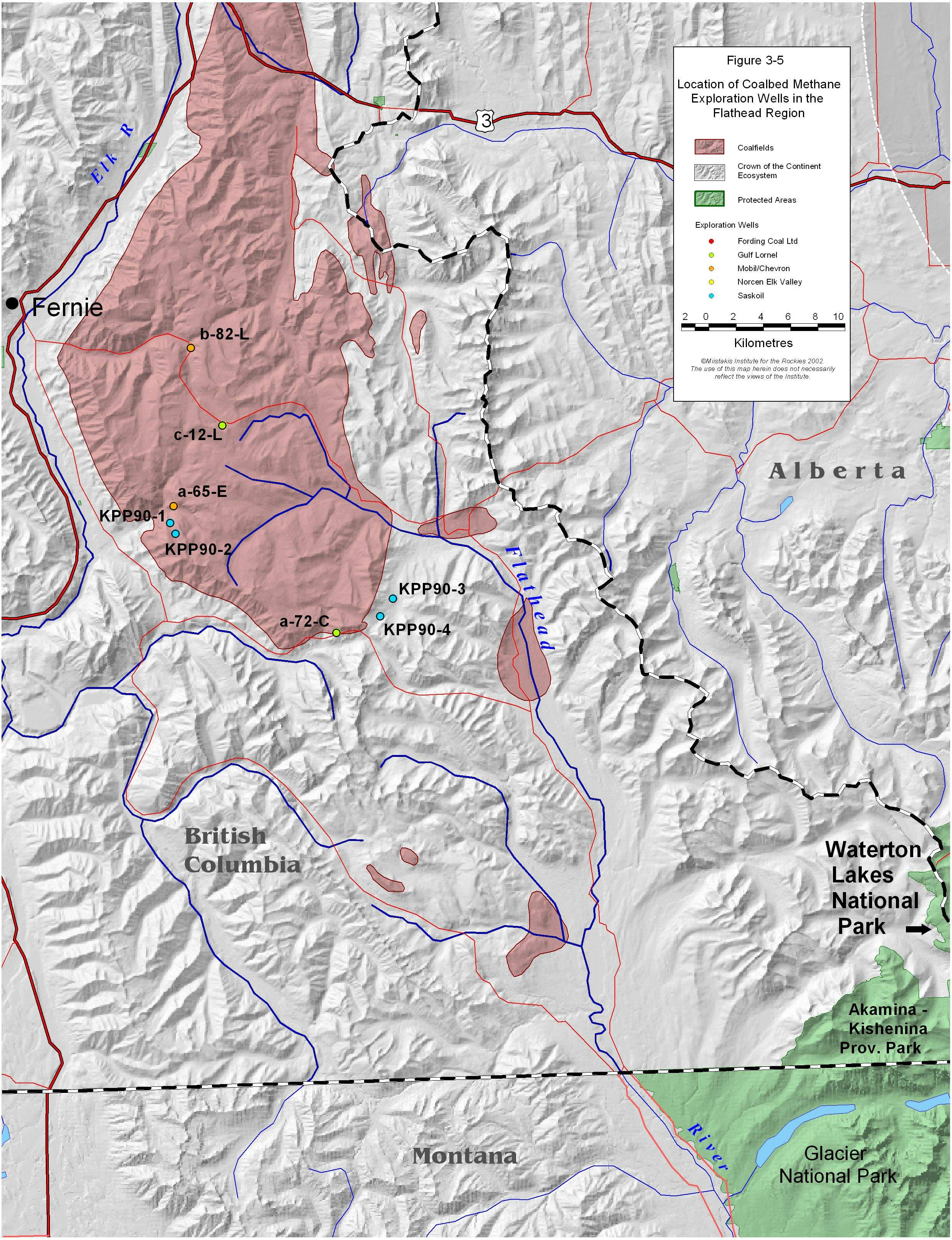
Flathead Coalfields Coalfield at Headwaters of British Columbia portion of the (North Fork) Flathead River. Map courtesy of the Miistakis Institute 712 KB File 1.2 MB File 1 MB Print File PDF |
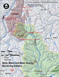
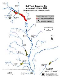
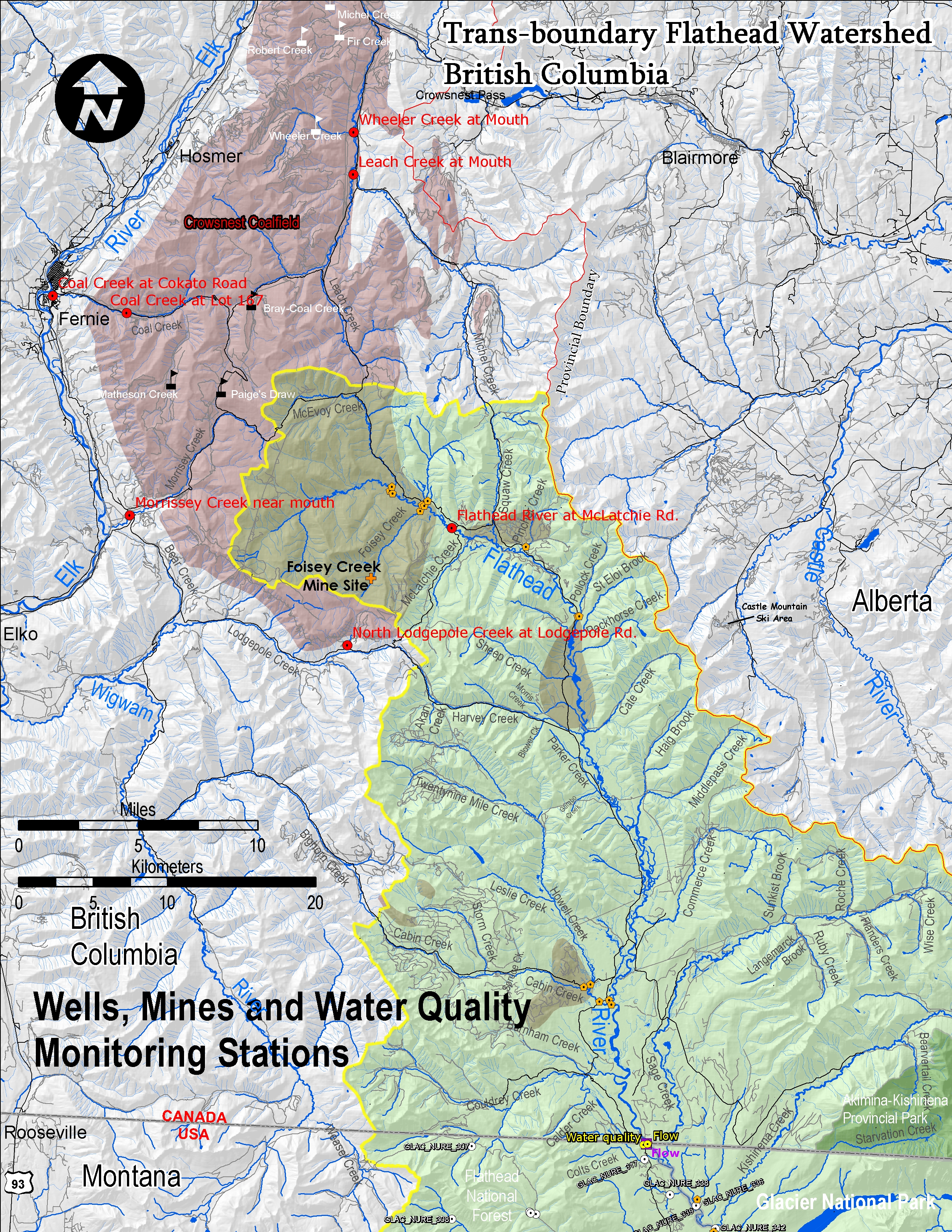
Wells, Mines and Water Quality Monitoring Stations Coalfield at Headwaters of British Columbia portion of the (North Fork) Flathead River with Foisey Creek 8.8 MB File |
|
© 2007 Flathead Basin Commission |